What is Connect the Countries?
Connect the Countries is a free daily geography game about borders. Two countries are marked on a globe, and you name the countries in between until the two are joined by land.
It is the map you carry in your head, tested one border at a time. Every guess is coloured by how good it was: on a shortest route, a longer way round, or off the route.
What it looks like
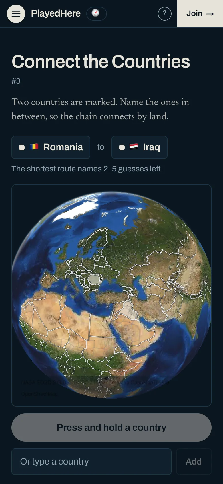
A new one every day
There is one pair a day, new at midnight Central Time, and it is the same pair for everyone. Routes get longer through the week: Monday's names 2 countries and Sunday's names 7 to 9.
How to play Connect the Countries
- 1Find the two marked countries on the globe. They are the start and the end.
- 2Press and hold a country you think is on the way. The button names it before you add it.
- 3Read its colour. Green is on a shortest route, yellow is on a route up to 1 country longer, and red is further off than that.
- 4Keep going until the countries you named join the two ends. You get as many guesses as the shortest route names, plus 3, or plus 4 on a route that names more than 4.
Tips
- Order does not matter. Name the border you are sure of first, wherever on the route it is.
- A piece of a country cut off from the rest carries no route. Kaliningrad does not join Poland to Russia, and French Guiana does not join France to Brazil.
- 4 fixed crossings count as land, the Channel Tunnel among them, so the United Kingdom can be on a route.
- A country too small to press can be typed in the box under the globe.
More daily games
Same idea, different subject. Each one is new every day and takes a couple of minutes. See them by shelf: sports trivia or geography games.
- Cities
- Geo Blitz
- Guess the Country
- Country Shapes
- Guess the Flag
- Satellite
- Hockey
- Soccer
- Baseball
- Olympics
- Football
- Golf
- Basketball
- Cricket
- Motorsport
- Tennis
And three with no day, to play as often as you like:
- Map Quiz. A country is named. Press it on the globe.
- Name the Countries. Name all the countries you can, against the clock.
- Capitals Quiz. A country or a state is named. Press its capital on the globe.
Connect the Countries questions
- What is Connect the Countries?
- A daily map game about borders. Two countries are marked on a globe and you name the countries in between, so the chain is joined by land.
- How many guesses do I get?
- As many as the shortest route names, plus 3. A route that names more than 4 countries gets 4 spare.
- What do the colours mean?
- Green is a country on a shortest route. Yellow is on a route up to 1 country longer. Red is further off than that, or on no route at all. A country is the same colour whenever you name it.
- How is it scored?
- It is scored by guesses, against the shortest route. A day is solved when the countries you named join the two ends, and the result is how many guesses that took beside how many the shortest route names. Run out of guesses and the day is a miss.
- What counts as a perfect day?
- Joining the two ends with exactly as many countries as the shortest route has, so that no guess is spare.
- Why does a border I know not count?
- A route is a walk, so a border counts only on the main part of both countries. Poland and Russia touch at Kaliningrad, which does not join the rest of Russia. 4 fixed crossings do count, because a road or a railway runs across each.
- Which countries can be the start or the end?
- 149 sovereign states. Island states with no fixed crossing are left out, because no route reaches them. A disputed place can be on a route where the map connects it, and is never a start or an end.
- Where do the borders come from?
- Borders are read from Natural Earth 1:50m, a public-domain map. 4 fixed crossings are counted as land, and a border that only reaches a cut-off piece of a country is not.
- When is there a new route?
- Every day at midnight Central Time. Everyone gets the same two countries.
- Is Connect the Countries free?
- Yes, with no account and nothing to download.
About PlayedHere
PlayedHere is a set of daily geography games played on one globe: sport by sport, city by city, and country by country. Story clues are written from public sources, and each one records the date a person checked it. A clue that only names a place is generated from that place’s record on Wikidata or Wikipedia, and links to its Wikidata entry. A clue that names a team is generated from that team’s record on Wikidata, compared with the list its league publishes or with what its home ground says on its own website, and links to the team’s Wikidata entry. See how to play, how scoring works or look up a country.